Location: |
66°36' S, 63°13' W, ~70 m a.s.l. (Argos id:29046) | 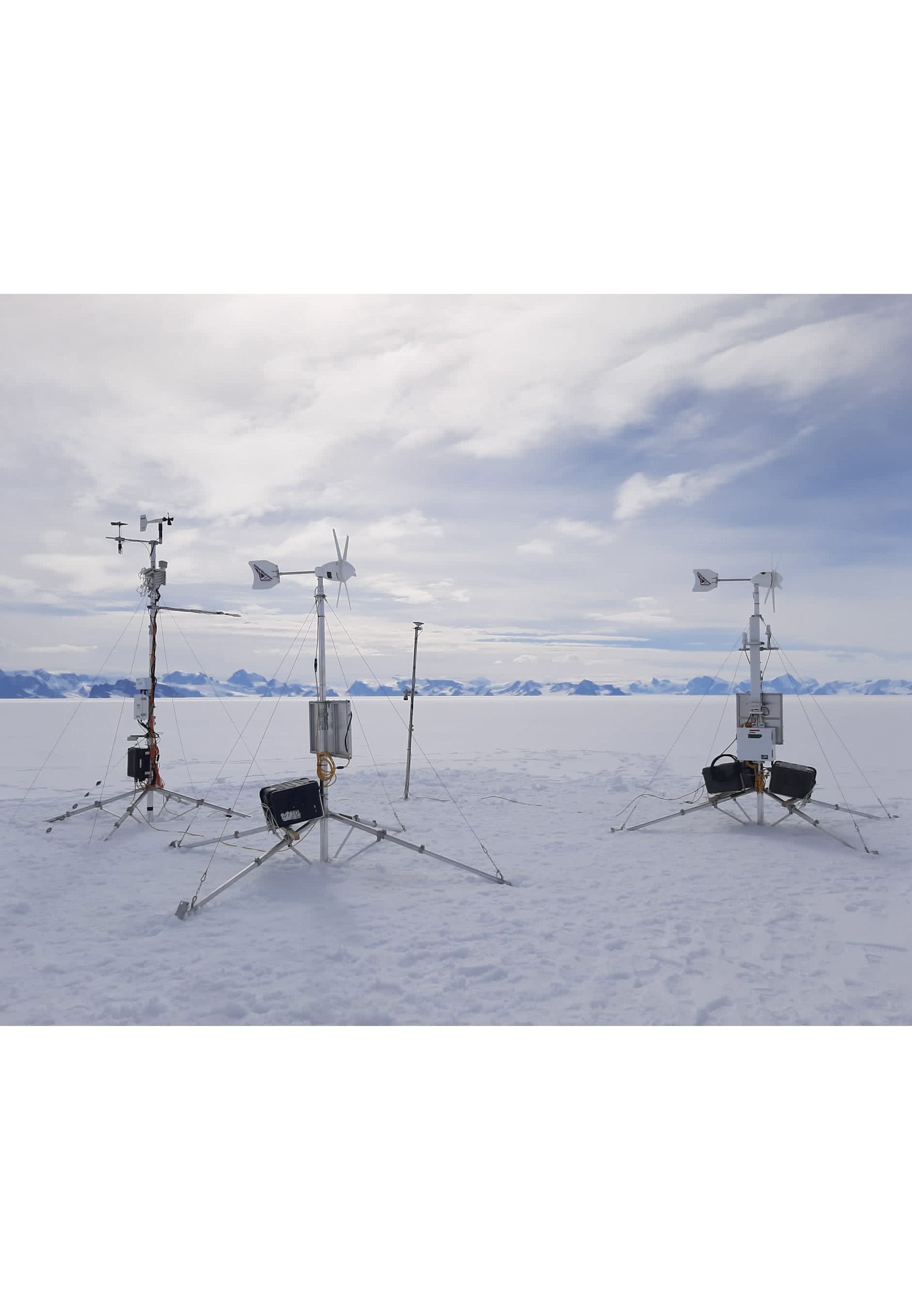 |
Operational: |
November 2022 to still operational | |
Remarks: |
The station is located close to the grounding line of the Larsen C ice shelf. The station was erected and is visited when weather permits once a year by BAS personnel. This station was originally named AWS18 and located about 20 km west of its current location. It was moved to ensure future accessibility. | |
Current calendar year | Last 7 days | |
Wind direction [deg] |  |  |
Wind speed [m/s] |  |  |
Wind speed max [m/s] |  |  |
Short wave in [W/m2] |  |  |
Short wave ref [W/m2] |  |  |
Long wave in [W/m2] |  |  |
Long wave out [W/m2] |  |  |
Temp. CNR1 [deg C] |  |  |
Air temp. [deg C] |  |  |
Rel. hum. [%] |  |  |
Air pressure [hPa] |  |  |
Sonic alt. [m] |  |  |
Melt wire [m] |  |  |
Snow temp. 1 [deg C] |  |  |
Snow temp. 2 [deg C] |  |  |
Snow temp. 3 [deg C] |  |  |
Snow temp. 4 [deg C] |  |  |
Snow temp. 5 [deg C] |  |  |
Snow temp. 6 [deg C] |  |  |
Snow temp. 7 [deg C] |  |  |
Snow temp. 8 [deg C] |  |  |
Temp. TC1 [deg C] |  |  |
Temp. TC2 [deg C] |  |  |
Tilt pitch [deg] |  |  |
Tilt roll [deg] |  |  |
Compass heading [deg] |  |  |
Battery usage [days] |  |  |
Memory usage [%] |  |  |
Battery voltage [V] |  |  |
Status [-] |  |  |
GPS latitude [deg] |  |  |
GPS longitude [deg] |  |  |
GPS height [masl] |  |  |
VWS [-] |  |  |
Argos data info | ||