Model description
In the 1990s the KNMI developed in cooperation with the Danish Meteorological Institute the research model RACMO based on the High Resolution Limited Area Model (HIRLAM) numerical weather prediction model. In 1993 UU/IMAU started to modify the model such that it better represented the extreme conditions over glacier surfaces. This first version of RACMO, RACMO1, combined the dynamical core of the HIRLAM model with ECHAM4 physics. The polar modified version of RACMO1 was mainly applied to the Antarctic Ice Sheet.
The second version, RACMO2, combines the dynamical core of the HIRLAM model with the European Centre for Medium-range Weather Forecasts (ECMWF) Integrated Forecast System (ISF) physics. Recently, RACMO2.4 was developed, which uses HIRLAM version 5.0.3 and includes an update from IFS cycle 33r1 to cycle 47r1 and the polar modifications already implemented in the previous RACMO versions.
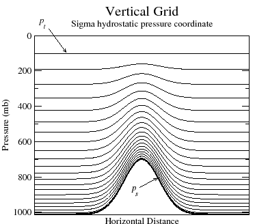 For the RACMO model in general the grids are defined over the equator and then rotated to the area of interest. Grid distance is defined in fraction of degrees, which results in near equidistant grid points as long as the domain is small enough. Note that the domain is thus not on a (polar) stereographic projection plane. In the vertical the model adopts a system of hybrid sigma levels, which evolve from terrain following sigma levels close to the surface to pure pressure levels at higher elevation. The actual number of horizontal grid points varies per model run; in most simulations 40 vertical layers were used.
Since RACMO is a regional model, it needs external information at the lateral boundaries and sea surface. At the lateral boundary zone of the model, the temperature, specific humidity, zonal and meridional wind components, and the surface pressure are relaxed towards the fields of a global model every 3 to 6 model hours, as are the sea surface temperature and sea ice concentration. Uper air relaxation is applied to larger domains since 2016, otherwise RACMO is not forced at the model top. The interior of the model is not nudged towards observations and allowed to evolve freely.
Model changes
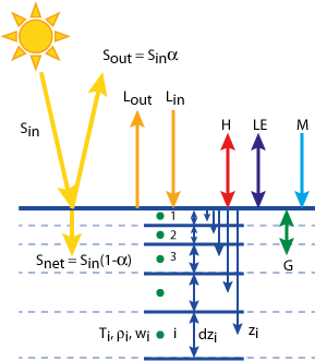
To improve the performance of the model over glaciated regions, several modifications have been made to the original model formulation. In RACMO1, the snow albedo parameterization, the characteristics of snow, the initialization of the temperature in the snow, and the roughness length were adapted. In addition, an extra vertical level was inserted at 7 m above the surface.
RACMO2.0 was interactively coupled to a four-layer dry snow model. To make application to the Greenland Ice Sheet possible, this model was replaced by a multi (up to 100) layer snow model which calculates melt, percolation, refreezing and runoff of meltwater.
In addition to the coupling to the multilayer snow model, RACMO2.1 also included an improved surface albedo scheme based on a prognostic scheme for snow grain size and a (constant) background ice albedo prescribed from MODIS fields, and a drifting-snow routine simulates the interactions of drifting snow with the surface and the lower atmosphere.
The modifications in the snow/ice model as incorporated in RACMO2.1 were also included in RACMO2.3, indicated by RACMO2.3p1. Here, px indicates that the original RACMO2.3 was modified for polar conditions, including x to indicate the version of the modifications. Note that RACMO2.2 does exist, but does not have a separate polar version. The RACMO2.3p2 model update incorporates upper-air relaxation, a revised topography, tuned parameters in the cloud scheme and modified snow properties.
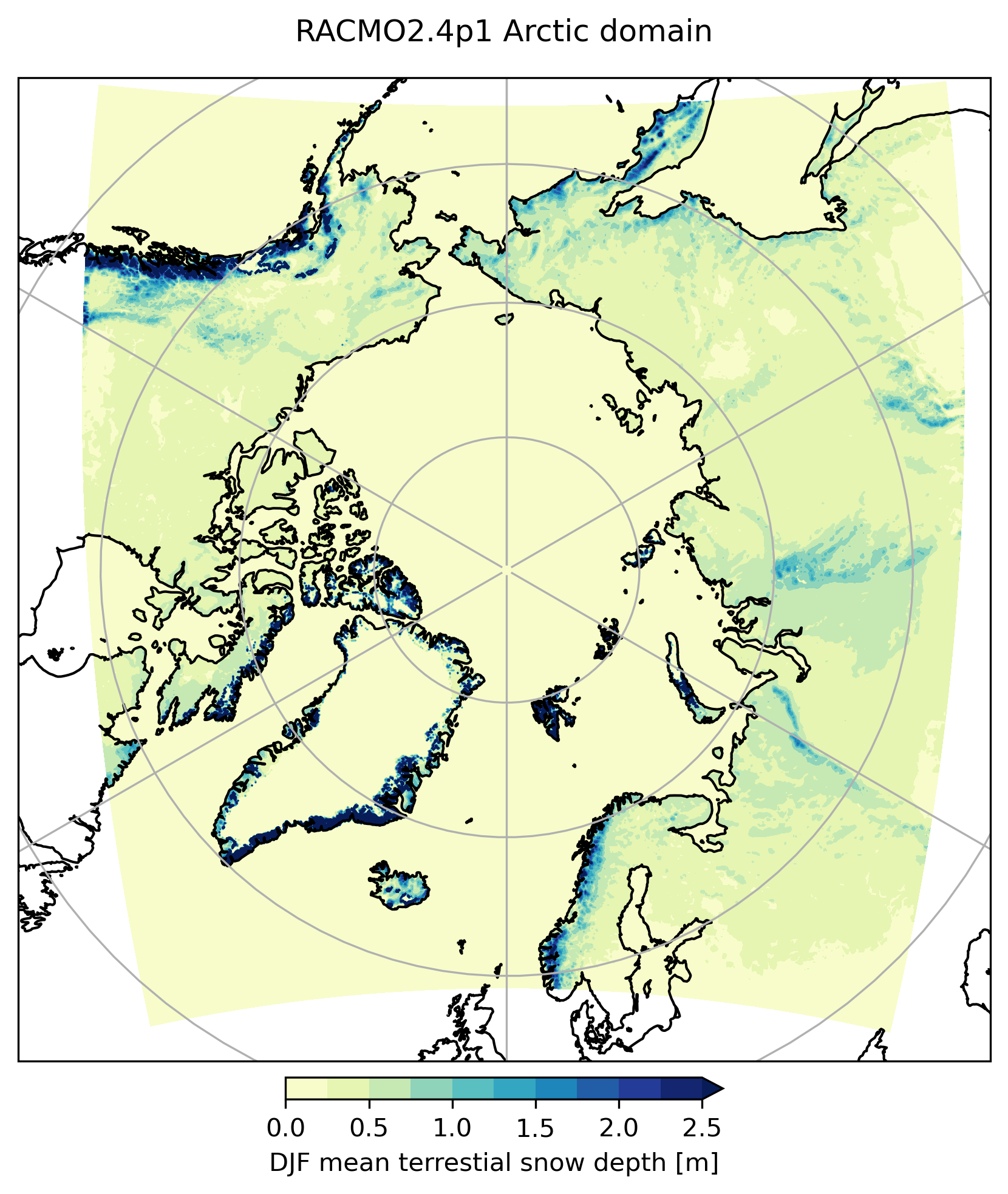
The latest RACMO version (RACMO2.4p1) has updates embedded in the physics parameterizations from ECMWF cycle 47r1, such as improvements of cloud and precipitation physics and inclusion of the ecRad radiation scheme. Next to the updates by the IFS cycle, there is now a fractional ice cover in which part of the grid cells are ice covered and other parts can be land. The narrowband albedo model Tartes is included since the non-operational RACMO2.3p3, which explicity resolves radiation penetration and subsurface heating. An updated and improved snowdrift model is also included. For the first time, RACMO is run on a pan-Arctic domain aligned with the CORDEX standard, allowing simulations not only of the Greenland Ice Sheet but also of other glaciated regions and terrestrial snow across the Arctic.
For an overview of the latest simulations and data products, see our data page.